Tocht Mountainbike Val de Bagnes - Verbier - Croix de Coeur - Photo
 verbier
verbier

Gebruiker

© OpenStreetMap contributors
Lengte
Lengte
20 km
Max. hoogte
Max. hoogte
2212 m
Positief hoogteverschil
776 m
Km-Effort
Km-Effort  
30 km
Min. hoogte
Min. hoogte
1499 m
Negatief hoogteverschil
774 m
Boucle
Boucle
Ja
Datum van aanmaak :
2014-12-10 00:00:00.0
Laatste wijziging :
2014-12-10 00:00:00.0

(0 Bericht)

Mountainbike
Mountainbike
2h15
Moeilijkheid : Onbekend

Scan deze QR-code om de tocht te openen in de SityTrail-applicatie

Gratisgps-wandelapplicatie

Logo SityTrail SityTrail

IGN / Geografische instituten

SityTrail uit de App Store downloaden SityTrail uit Google Play downloaden

Logo SityTrail SityTrail World

De wereld gaat voor u open

SityTrail uit de App Store downloaden SityTrail uit Google Play downloaden SityTrail op Huawei AppGallery downloaden

Over ons

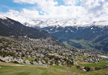
Tocht Mountainbike van 20 km beschikbaar op Valais/Wallis, Entremont, Val de Bagnes. Deze tocht wordt voorgesteld door verbier.

Beschrijving

Partir de la place centrale, monter vers Médran (remontées mécaniques), suivre la route de Ransou puis tourner à droite en direction de Clambin. Suivre la route jusqu''au restaurant du Carrefour. De là, monter aux Ruinettes, ensuite continuer sur la route de La Planie jusqu''à la Croix de Coeur. De là-haut redescendre en station par le quartier des Esserts.

Hoogteprofiel

Plaatsbepaling

Land:
Switzerland
Regio :
Valais/Wallis
Departement/Provincie :
Entremont
Gemeente :
Val de Bagnes
Locatie:
Unknown
Vertrek:(Dec)
Vertrek:(UTM)
363114 ; 5106244 (32T) N.

Wandeltochten in de omgeving

Tocht Te voet Val de Bagnes - Vollèges - Levron - Photo
Te voet
PRO

Te voet

Gemakkelijk
Val de Bagnes, Valais/Wallis, Entremont, Switzerland
3,3 km | 7,8 km-effort
1h 46min
Neen
Tocht Te voet Val de Bagnes - Vollèges - Levron - Photo
Te voet
PRO

Te voet

Gemakkelijk
Val de Bagnes, Valais/Wallis, Entremont, Switzerland
5,4 km | 10,3 km-effort
2h 20min
Neen
Tocht Te voet Val de Bagnes - Ancien Bisse du Levron - Photo
Te voet
PRO

Te voet

Gemakkelijk
Val de Bagnes, Valais/Wallis, Entremont, Switzerland
10,7 km | 13,4 km-effort
3h 2min
Neen
Tocht Stappen Val de Bagnes - Le Châble – Cabane de Louvie / Jour 2 - Photo
Stappen
Greg813

Stappen

Moeilijk
Val de Bagnes, Valais/Wallis, Entremont, Switzerland
12,4 km | 21 km-effort
3h 37min
Neen
Tocht Te voet Val de Bagnes - Promenade de la Dranse - Photo
Te voet
PRO

Te voet

Gemakkelijk
Val de Bagnes, Valais/Wallis, Entremont, Switzerland
7,1 km | 9,4 km-effort
2h 8min
Neen
Tocht Te voet Val de Bagnes - Bruson - Moay - Photo
Te voet
PRO

Te voet

Gemakkelijk
Val de Bagnes, Valais/Wallis, Entremont, Switzerland
3,6 km | 10 km-effort
2h 16min
Neen
Tocht Stappen Riddes - Croix de Coeur - Pierre Avoi - Photo
Stappen
jptritten

Stappen

Medium
(2)
Riddes, Valais/Wallis, Martigny, Switzerland
6,4 km | 10,9 km-effort
2h 26min
Ja
Tocht Te voet Isérables - Le Rosey - Taillay - Photo
Te voet
PRO

Te voet

Gemakkelijk
Isérables, Valais/Wallis, Martigny, Switzerland
4,4 km | 5,7 km-effort
1h 18min
Neen
Tocht Te voet Sembrancher - Chemins pédestre, commune de Sembrancher - Photo
Te voet
PRO

Te voet

Gemakkelijk
Sembrancher, Valais/Wallis, Entremont, Switzerland
4,9 km | 11,3 km-effort
2h 34min
Neen


Sluiten
Mijn abonnementen